VEU717L East Mediterranean & Black Sea — Магазин — Navigarin

VEU717L East Mediterranean & Black Sea

10154
4 000 p.
В наличии
1
Информация о товаре

Карты глубин Черного моря для garmin


BlueChart® g2 Vision® HD - VEU717L - East Mediterranean & Black Sea - microSD™/SD™


Coverage:
Detailed

coverage of the Eastern Mediterranean Sea and the Black Sea including

the Straights of Messina, the Adriatic Sea up to Pescara, IT, the Aegean

Sea, the Suez Canal and Upper Red Sea, the Bosphorus Straight, the

Dardanelles and the Sea of Azov. Ports included are Syracuse and

Taranto, IT; Split, HR; Athens, GR; Istanbul, Antayla and Trabzon, TR;

Odessa, UA; Sevastopol and Yalta, RU; and Alexandria, EG.


Premium Mapping and Graphics Capabilities

  • Detailed nautical charts, in vector object oriented format, derived from government charts and private sources to provide port plans, depth contours, navigational aids, and tides and currents in a seamless chart presentation
  • Shaded depth contours and intertidal zones with spot soundings
  • Aerial photos of ports, marinas, bridges and navigational landmarks and realistic "view from space" high-resolution satellite imagery
  • Up to 1-foot HD contours provide a more accurate depiction of bottom structure for improved fishing charts and navigation in swamps, canals, marinas and port plans
  • Garmin Auto Guidance 3.0 technology is now capable of providing routing guidance¹ to virtually any accessible destination on the water
  • Worldwide coverage available in regionalized cuts

Based

on the standard BlueChart® g2 HD features, BlueChart g2 Vision HD

provides premium mapping and graphics capabilities. Plug a BlueChart g2

Vision HD card into your compatible chartplotter's microSD™/SD™ card

slot to tremendously expand its mapping capabilities.


BlueChart

g2 Vision HD is our premium marine cartography for use with Garmin

chartplotters. It includes all the features of BlueChart g2 HD charts

and adds Garmin exclusive Auto Guidance 3.0. Garmin Auto Guidance 3.0

technology quickly searches relevant charts to suggest a course

according to your boat's dimensions and creates a visual path that seeks

to avoid low bridges, shallow water and other charted obstructions.

With version 3.0, Auto Guidance can guide the user and in and out of

more places more effectively, including entering and exiting marinas.¹


BlueChart

g2 Vision HD features seamless chart presentation with 1-foot HD

contours that provide a more accurate depiction of bottom structure for

improved fishing charts and enhanced detail in swamps, canals and port

plans. It also provides enhanced labeling for more coastal cities and

ports.


In addition to highly detailed nautical chart data,

BlueChart g2 Vision HD also adds 3-D above and below the waterline,

aerial photos, satellite imagery and coastal roads as well as points of

interest.


Plug a BlueChart g2 Vision HD card into your compatible

chartplotter's SD card slot and you will tremendously expand its

charting capabilities.


Enter the World of Auto Guidance 3.0
By

adding a BlueChart g2 Vision HD card to your compatible chartplotter,

you can take advantage of patented Garmin Auto Guidance 3.0 technology.

Enter the location where you want to go and Auto Guidance 3.0 instantly

searches through relevant charts to create a path specifically designed

for the dimensions of your boat. Auto Guidance provides a visual path

that seeks to avoid low bridges, shallow water and other charted

obstructions. But it also provides navigational solutions, such as

entering and exiting marinas.¹ When Auto Guidance 3.0 is coupled with a

Garmin autopilot system, you can engage your compatible autopilot to

follow the Auto Guidance route, and it will keep you on route,

automatically.


Enhance Your Vision
High-resolution

satellite imagery enhances chart depictions for superior situational

awareness so you can navigate with a clear moving-map representation of

your boat's position. It's our most realistic mapping display in a

chartplotter.


Auto Guidance 3.0 searches though all relevant

charts to create a route that seeks to avoid obstacles, shallow water,

buoys and other obstructions.¹

  • High resolution imagery with navigational charts overlaid gives you a realistic view of your surroundings
  • Crystal clear aerial photography shows exceptional detail of many ports, harbors and marinas
  • MarinerEye view provides a 3-D representation of the surrounding area both above and below the waterline
  • FishEye view provides a 3-D representation of the ocean floor as seen from below the waterline


Get the Best View
BlueChart

g2 Vision HD data lets you select true 3-D MarinerEye view or FishEye

view perspective for dynamic views both above and below the waterline.

Auto Guidance 3.0 technology suggests the best routes to follow. Aerial

photos of ports, harbors, marinas, waterways and coastal roads help you

see "the big picture" when you're on the water.


Features:

  • Up to 1-foot HD fishing contours
  • Seamless chart presentation
  • Vector object-oriented data
  • Shaded depth contours and intertidal zones with spot soundings
  • Port plans
  • Tidal stations for selected countries
  • Aids to navigation with view range and coverage, including light sectors information
  • Wrecks, restricted areas, anchorages, obstructions
  • Tidal current graphs
  • 2-D or 3-D map perspective view
  • Marina points of interest and slipways
  • Full bathymetric fishing charts providing detailed contours
  • Auto Guidance 3.0¹ technology to suggest best passages
  • Full color aerial photos of ports, marinas, bridges and navigational landmarks
  • Detailed coastal roads up to 5 miles inland (non-routable)
  • Points of interest such as restaurants, lodging, entertainment and more
  • Realistic "view from space" high-resolution satellite imagery
  • True 3-D-view below-waterline perspective and 3-D Mariner's Eye View
  • Tidal current flow overlay


¹Auto Guidance is for planning purposes only and does not replace safe navigation operations


*Some BlueChart products may contain C-MAP by Jeppesen data. © 2016 Jeppesen. All rights reserved.

Сохраните этот товар в закладках

Подпишись на новости

.

Thank you! Your submission has been received!

Oops! Something went wrong while submitting the form

Instagram

Магазин лучших карт в России

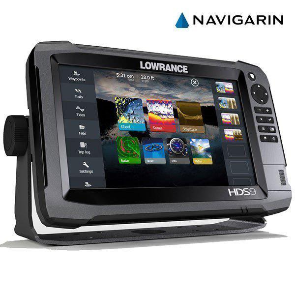
Всем нашим покупателям доступна электронная картографическая продукция, которая обязательно нужна для тех, кто проходит или проезжает десятки мест в сезон. Без нормальной карты такой поход практически невозможен. То, что выставлено во всемирной сети в бесплатном доступе, часто очень далеко находится от реальности, либо продукция изготовлена в сомнительном качестве. Наш магазин картографии работает по всей России, а это именно то, что нужно для успешного похода или экспедиции. Только у нас доступно самое широкое разнообразие продукции подобного рода. Здесь можно купить навигационную карту для современных навигаторов, которая всегда будет в точности показывать ваше положение на местности в текущий момент времени.

Новые карты – новые возможности

Каждый, кому требуется такая продукция, является своего рода путешественником, только задачи могут быть совершенно разные. Туристы, грибники, рыбаки, охотники, любители путешествий на квадроциклах и внедорожниках, и просто искатели интересных мест – всех их объединяет общее желание разведывать новые области, но без карт это не представляется возможным.

Например, у нас можно купить карту для навигатора Гармин, потому что это самая распространенная фирма в мире, выпускающая подобные устройства. Мы гарантируем строгое соответствие и отсутствие различных ошибок при загрузке и использовании. Это фирменное программное обеспечение, которое существенно расширит возможности вашего навигатора сразу же после установки. Различные типы карт, которые продаются в нашем магазине, привязаны к стандартным картам.

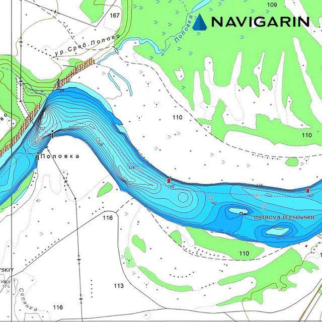
Для того, чтобы изучать изменения местности за последние годы, можно сравнить несколько различных версий карт. Это позволит отыскать забытые тропы к брошенным деревням, а возможно получится совершить и сенсационное открытие, отыскать новые интересные находки с металлоискателем и т.д.

Посетите наш интернет магазин навигационного оборудования

Если вы до сих пор не являетесь обладателем подобного устройства, то считайте, что во многом себя обделяете. Например, можно отмечать на современных навигаторах точки найденных интересных мест, грибные поляны, тропы или рыбные места. Всё это будет доступно в небольшом устройстве, которое помещается в карман. Также будет необходимо купить карты для навигатора Garmin, которые в комплекте не поставляются. Зато после этой покупки вы никогда не заблудитесь даже в ущельях или глухой тайге, потому что такие устройства отлично принимают сигнал где угодно.